Property Record
3885 Highway 138 Se, Stockbridge, GA 30281

NEARBY LISTINGS FOR SALE OR LEASE
Property Detail
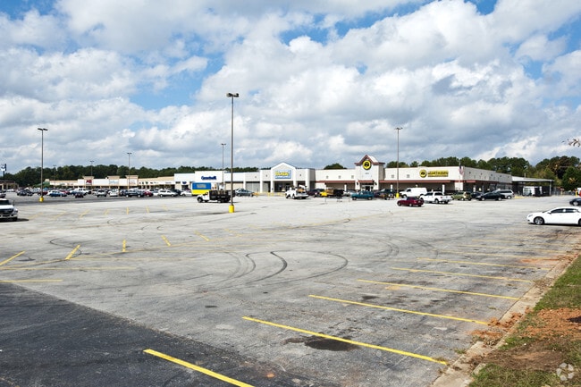
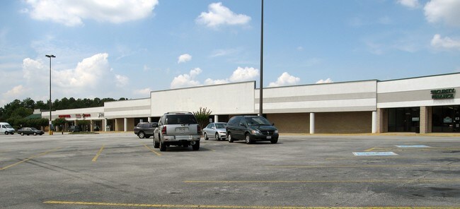
3885 Highway 138 Se
12-0072B-00A-004
Freeman Jct Shopping Center
Communitycenter
Clayton
X
Georgia
13063C0092F
10.18 AC
2024
Forest Park/Morrow
2024
Atlanta
040617
Atlanta-Sandy Springs-Roswell, GA
14,862 SF
DEMOGRAPHICS near 3885 Highway 138 Se
1 Mile
3 Mile
5 Mile
2024 Total Population
10,428
61,309
130,296
2029 Population
10,791
63,225
134,580
Pop Growth 2024-2029
+ 3.48%
+ 3.13%
+ 3.29%
Average Age
35
37
38
2024 Total Households
3,935
21,845
46,962
HH Growth 2024-2029
+ 3.30%
+ 3.06%
+ 3.40%
Median Household Inc
$49,350
$59,039
$61,229
Avg Household Size
2.60
2.70
2.70
2024 Avg HH Vehicles
2.00
2.00
2.00
Median Home Value
$153,915
$181,974
$191,742
Median Year Built
1995
1994
1992
Nearby Places
Map Layers
Map Styles
 Street
 Aerial
- Restaurants
- Banks
- Shops
- Fitness
- Groceries
PUBLIC TRANSPORTATION
AIRPORT
Hartsfield - Jackson Atlanta International
DRIVE
WALK
Distance
Hartsfield - Jackson Atlanta International
20 min
13.8 mi
Freight Ports
Georgia Ports - Savannah
DRIVE
WALK
Distance
Georgia Ports - Savannah
257 min
230.5 mi
SALE & LEASE HISTORY
LISTING DATE
SALE/LEASE

Dec 09, 2016
For Lease
Nearby Properties
Address
Land Use
TOTAL SIZE
Lot Size
Zoning
Address
Land Use
TOTAL SIZE
Lot Size
Zoning
368 SF
42.85 AC
RM
Address
Land Use
TOTAL SIZE
Lot Size
Zoning
284 SF
29 AC
RM
Address
Land Use
TOTAL SIZE
Lot Size
Zoning
35,082 SF
31.82 AC
C3
Address
Land Use
TOTAL SIZE
Lot Size
Zoning
17,862 SF
30 AC
PD
Address
Land Use
TOTAL SIZE
Lot Size
Zoning
330 SF
33.30 AC
RM
Address
Land Use
TOTAL SIZE
Lot Size
Zoning
216 SF
31.17 AC
RM
Address
Land Use
TOTAL SIZE
Lot Size
Zoning
217,289 SF
52.12 AC
OI
Address
Land Use
TOTAL SIZE
Lot Size
Zoning
18.12 AC
MXR
Address
Land Use
TOTAL SIZE
Lot Size
Zoning
200 SF
19.94 AC
RM
Address
Land Use
TOTAL SIZE
Lot Size
Zoning
2,426 SF
19.79 AC
RM
Address
Land Use
TOTAL SIZE
Lot Size
Zoning
707,780 SF
85.14 AC
MXI
Address
Land Use
TOTAL SIZE
Lot Size
Zoning
20.65 AC
RM
Address
Land Use
TOTAL SIZE
Lot Size
Zoning
158 SF
15.59 AC
RM
Address
Land Use
TOTAL SIZE
Lot Size
Zoning
87,449 SF
14 AC
MC
Address
Land Use
TOTAL SIZE
Lot Size
Zoning
200 SF
22 AC
RM
Address
Land Use
TOTAL SIZE
Lot Size
Zoning
200 SF
25 AC
RM
Address
Land Use
TOTAL SIZE
Lot Size
Zoning
200 SF
19 AC
RM
Address
Land Use
TOTAL SIZE
Lot Size
Zoning
525 SF
103.20 AC
RM
Address
Land Use
TOTAL SIZE
Lot Size
Zoning
180 SF
30 AC
RM
Address
Land Use
TOTAL SIZE
Lot Size
Zoning
182 SF
19.46 AC
RM
Address
Land Use
TOTAL SIZE
Lot Size
Zoning
142,742 SF
27.10 AC
RS110
Address
Land Use
TOTAL SIZE
Lot Size
Zoning
8.02 AC
MXR
Address
Land Use
TOTAL SIZE
Lot Size
Zoning
116 SF
11.42 AC
RM
Address
Land Use
TOTAL SIZE
Lot Size
Zoning
120 SF
26.48 AC
RM
Address
Land Use
TOTAL SIZE
Lot Size
Zoning
1,638 SF
12.79 AC
RM
Address
Land Use
TOTAL SIZE
Lot Size
Zoning
160 SF
20 AC
RM
Address
Land Use
TOTAL SIZE
Lot Size
Zoning
391,708 SF
20.04 AC
C2
Address
Land Use
TOTAL SIZE
Lot Size
Zoning
127,735 SF
20.74 AC
M1
Address
Land Use
TOTAL SIZE
Lot Size
Zoning
121 SF
15.49 AC
RM
Address
Land Use
TOTAL SIZE
Lot Size
Zoning
8,590 SF
11.09 AC
R3
The World's #1 Commercial Real Estate Marketplace
Connect with us
© 2025 CoStar Group
The information above has been obtained from sources believed reliable. While we do not doubt its accuracy we have not verified it and make no guarantee, warranty or representation about it. It is your responsibility to independently confirm its accuracy and completeness. Any projections, opinions, assumptions, or estimates used are for example only and do not represent the current or future performance of the property. The value of this transaction to you depends on tax and other factors which should be evaluated by your tax, financial, and legal advisors. You and your advisors should conduct a careful, independent investigation of the property to determine to your satisfaction the suitability of the property for your needs.